Land Use
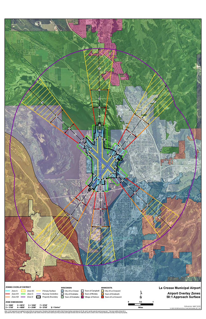
The City of La Crosse has adopted a Land Use Ordinance outlining building and height restrictions within 3 miles of the La Crosse Airport property boundary. The purpose of this ordinance is to protect the taxpayer's investment in the airport by ensuring that the approaches to the airport are protected from obstructions or otherwise incompatible land uses.
The municipalities of La Crosse, Onalaska, Holmen, Campbell, and Medary are included in part within the 3-mile protection zone. Please contact your local zoning administrator for more information on specific requirements for your project. A 7460-1 form is also required when building within the 3-mile zone, applications may be Completed Here.
Public GIS Zoning Site provides an easy to use summary of airport height and land use restrictions
Zoning Checklist Form is required by your municipality when completing a permit application
Chapter 8 of the Code of Ordinances of the City of La Crosse adopted by the Common Council of the City of La Crosse
Height Map covers a 3 mile radius around the airport
Land Use Plan is a full land use plan used in determining impacts of various land uses around the airport
WI Statute 114 authorizing legislation for local zoning control